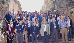
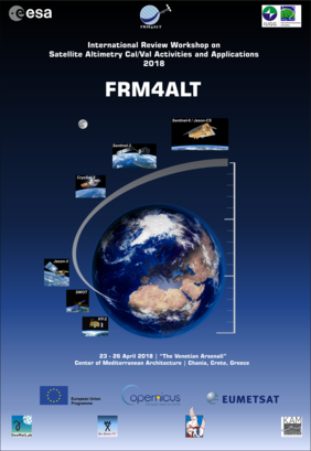
The “International Review Workshop on Satellite Altimetry Cal/Val Activities and Applications” has concluded its activities. It was held at the Venetian Arsenali, Center of Mediterranean Architecture, Chania, Crete, Greece 23-26 April, 2018. It has been sponsored by the European Space Agency, The International Association of Geodesy, EUMETSAT, and organized by the Technical University of Crete and Space Geomatica.
It has been an extremely successful International Meeting both in terms of its scientific content, international participation, in a beautiful setting which has been conducive to essential scientific collaboration. More than 70 participants from India, Taiwan, Australia, United Kingdom, Germany, France, Hungary, The Netherlands, Estonia, Italy, Spain, Portugal, The United States of America, Canada, Greece, Denmark, and China contributed to this event. Space Agencies and international organizations and Institutes, such as the European Space Agency, Eumetsat, NASA/Jet Propulsion Laboratory, Indian Space Research Organization, Centre national d'études spatiales [CNES, French Space Agency], National Physical Laboratory (United Kingdom), Metrology Labs (USA), European Reference Frames and Systems, the Danish Space Center, the International Association of Geodesy/International Union of Geodesy and Geophysics have been represented in this Meeting. All present and future altimetry satellite missions, such as Sentinel-3, CryoSat-2, Sentinel-6/Jason-CS, SARAL/AltiKa, Jason, SWOT, Copernicus missions and HY-2, etc. had been the target of this event.
The aim of this International Review Workshop has been to present the latest research results in the field of satellite altimetry calibration and altimetry applications for monitoring ocean changes and for improving Earth observation in an objective, continuous, homogeneous and reliable manner, free of errors and biases, and tied from one altimetry mission to the next.
Presentations covered subjects, such as Fiducial Reference Measurements for Altimetry, Fundamental time systems for altimetry standardization, New missions of altimetry from the European Space Agency, NASA (USA), CNES (France), China, and ISRO (India) altimetry missions, Precise orbit determination, International trends in altimetry calibration, Estimation of uncertainties for satellite observations based upon metrology standards (speed of light, absolute time, etc.), Calibration of future satellite altimetry, the ESA Climate Change Initiative, the Changing environment, Polar region applications, modelling of bathymetry, geoid, sea level gravity, heights etc., by altimetry, etc.
The intention has been to support long-term monitoring of climate changes by understanding better environmental changes on world's oceans, terrestrial surface waters, but also on Arctic and Antarctic polar regions. The final outcome has been to establish and promote a scientific roadmap with procedures, protocols, guidelines, and best practices in an open and transparent way to be followed by any international group working on satellite altimetry to attain SI (Système international) traceability of their measurements, results and data products.
This International Cal/Val Review could not have been done without the support provided by The European Space Agency, Eumetsat, the International Association of Geodesy, The European Union and its Copernicus program, the Technical University of Crete, Space Geomatica and the Center of Mediterranean Architecture. We thank them all very much for giving us this great opportunity to make this Review Workshop on International Altimetry Cal/Val Activities and Applications a successful event.
Fiducial Reference Measurements for Altimetry | Watch the video


