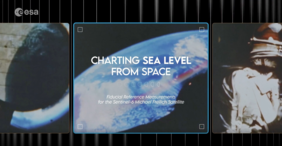
Titled “Charting sea level from space”, this newly launched documentary on European Space Agency (ESA)'s website, provides an insight to Technical University of Crete (TUC)'s Permanent Facility for Altimetry Calibration, in Gavdos, Greece. The facility was inaugurated in Fall 2021 and is operated and maintained jointly by the Technical University of Crete and the Laboratory of Geodesy and Geomatics Engineering, directed by Professor Stelios Mertikas, on one hand and the European Space Agency on the other. The Permanent Facility for Altimetry Calibration will assist in the development of new methods of calibrating altimetry satellites resulting in the provision of more accurate measurements on sea level.
The GVD1 Transponder Cal/Val, developed and built by the Technical University of Crete and the European Space Agency and installed in the White Mountains of Crete and recently in the Gavdos Island, will monitor the satellite measurements of the Copernicus satellite altimetry constellation and the data will be analyzed by a team of 15 scientists from TUC, ESA, Eumesat in Germany, French Space Agency, NASA, NOAA and ESA associates in France, Spain, Italy and Germany.
The documentary foregrounds Prof. Stelios Mertikas and Dr. Craig Donlon, Head of ESA’s Earth Surfaces and Interior Earth and Mission Science Division, who discuss the importance of altimetry and satellite imaging in improving how we measure, predict and envision a new outlook of our world and our survival in the future to come. It also documents the first measurement taken by the newly launched satellite Sentinel-6A and its predecessor Jason-3 on October 11th 2021 in the Gavdos island.


